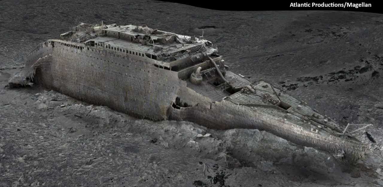
In photographs released in May, a high-tech 3D underwater scanning procedure reconstructed the wreckage of the famed ship Titanic in stunning detail.
In what experts are calling the greatest underwater scanning effort in history, the fatal ocean liner was documented as it sat on the sea bed.
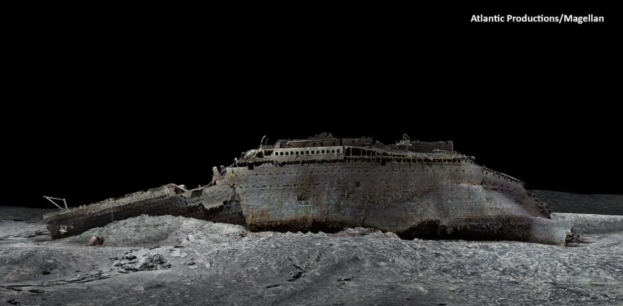
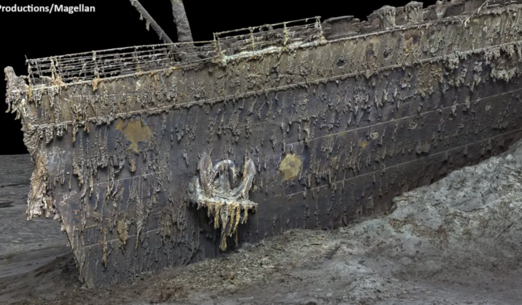
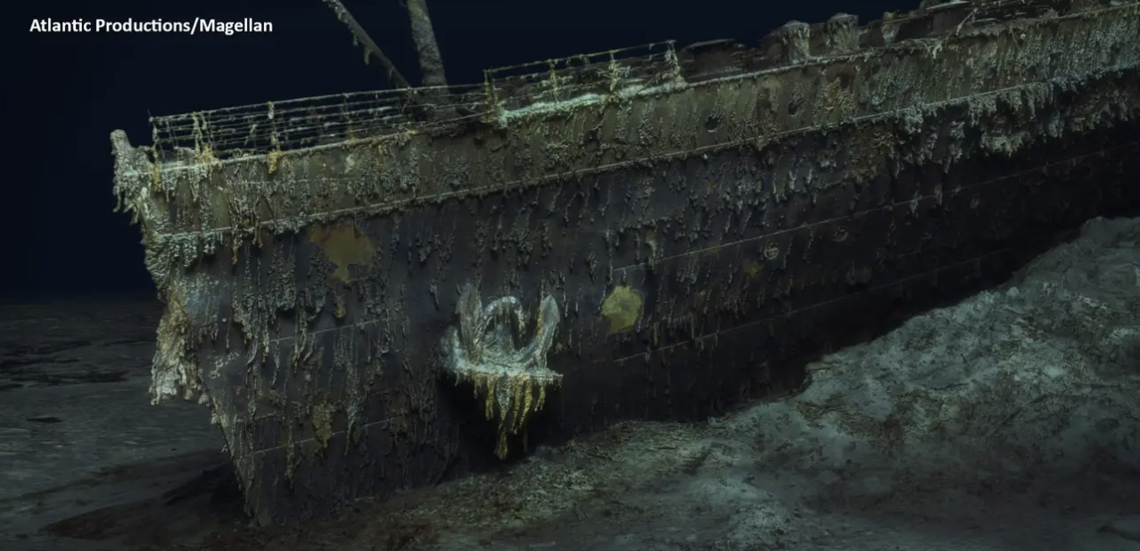
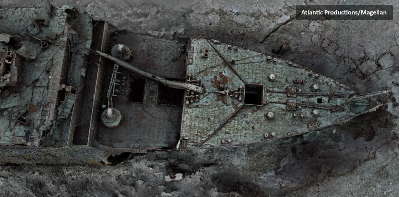
Magellan, the deep sea specialist that created the scans, employed two submersibles that traveled 12,500 feet below to create what they call the Titanic’s “digital twin,” as well as map the surrounding debris field.
The scans required sixteen terabytes of data and more than 715,000 still photos, according to the researchers.
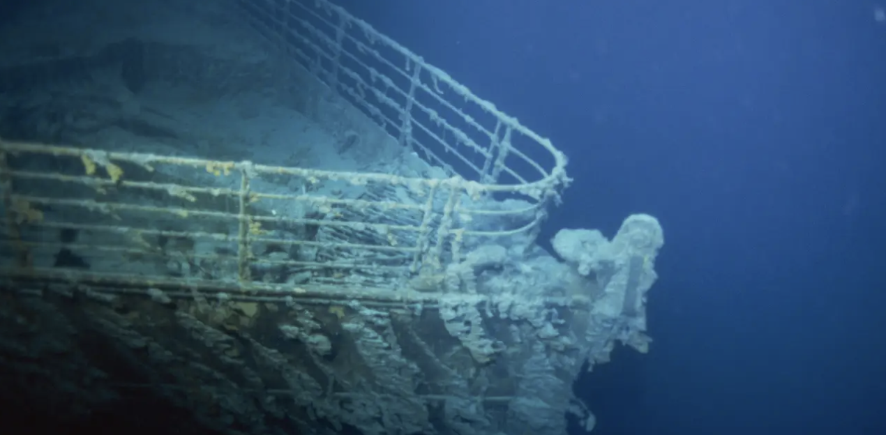
According to experts, investigating the wreck is a crucial matter because the wreckage of the ship degraded dramatically during a 2019 dive. Scientists anticipate that the once-proud passenger ship will be lost by 2030 owing to harsh deep-sea temperatures and microorganisms that eat away at the metal. Previously, traditional underwater photography and filming had to contend with low illumination at the ocean’s bottom, resulting in murky, gloomy photographs like this one from 1996:
Parks Stephenson, an expert on the Titanic, said the new scans are a “true game-changer” for study on the ship, which struck an iceberg in the North Atlantic on its maiden voyage and perished in April 1912, killing over 1,500 people.
“What we are seeing for the first time is an accurate and true depiction of the entire wreck and debris site,” Stephenson explained.
The wreck was not disturbed throughout the scanning procedure, according to the researchers.
Stephenson went on to say that the scans reveal “details that none of us have ever seen before,” which opens the door to further Titanic study. “We have actual data that engineers can use to investigate the true mechanics of the Titanic’s breakup and sinking, bringing us even closer to the true story of the Titanic disaster.”
The team had to withstand harsh sea conditions in order to capture the photographs. “This was a challenging mission,” stated Magellan Founder and CEO Richard Parkinson. “We had to fight the elements, bad weather, and technical challenges in the middle of the Atlantic to complete this unprecedented Titanic mapping and digitalization operation.”
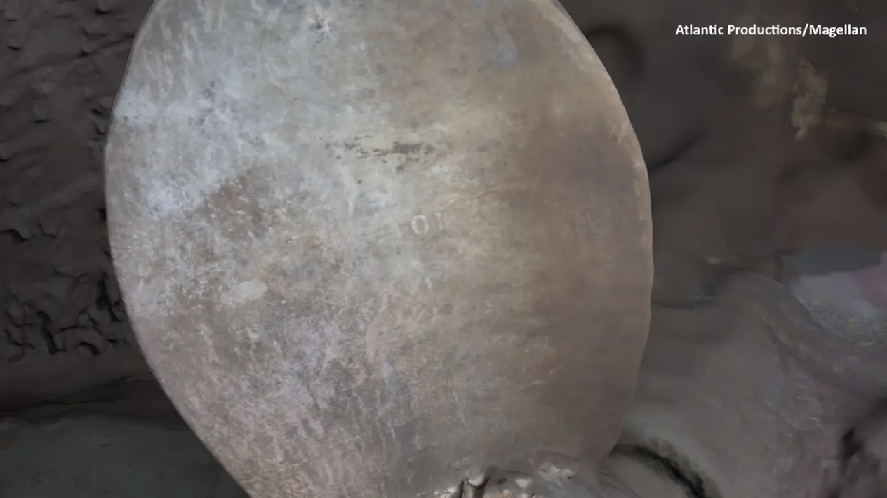
However, Gerhard Seiffert, a Magellan 3D capture specialist, stated, “When we saw the data come in, it was all worth it—the level of detail we saw and recorded was extraordinary.”
This includes the serial number printed on one of the propellers, which can be seen faintly even though it has worn away due to time and underwater circumstances.
“Previously, video permitted you to see just a tiny portion of the crash at a time. “With this model, people will be able to zoom out and see the entire thing for the first time,” Seiffert explained.
The Titanic is returning to the surface in an intriguing new fashion, more than 100 years after its fatal collision with an iceberg and subsequent sinking.
“This is the Titanic as no one has ever seen it before,” Seiffert explained.