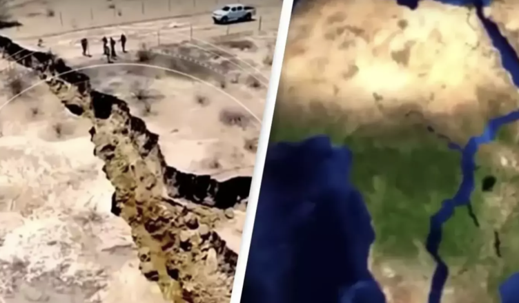
Scientists observed the development of a new ocean as Africa began to separate earlier this year in a surprising discovery.
Researchers discovered that the two portions of land that make up the world’s second-largest and second-most populous continent had begun to separate, allowing for the formation of a new ocean to flow across the divide.
If the land mass continues to split, countries such as Zambia and Uganda may one day have their own coastlines.
According to the peer-reviewed journal Geophysical Research Letters, scientists have confirmed the formation of a new ocean as the African continent splits in half.
Scientists have pinpointed the precise location where the continent, which spans over 30 million square kilometers, initially emerged from deep underneath.
The fracture is located on the boundaries of three tectonic plates that have been progressively drifting apart for some time.
Geologists have observed that this intricate tectonic process will allow for the formation of a whole new body of water millions of years from now.
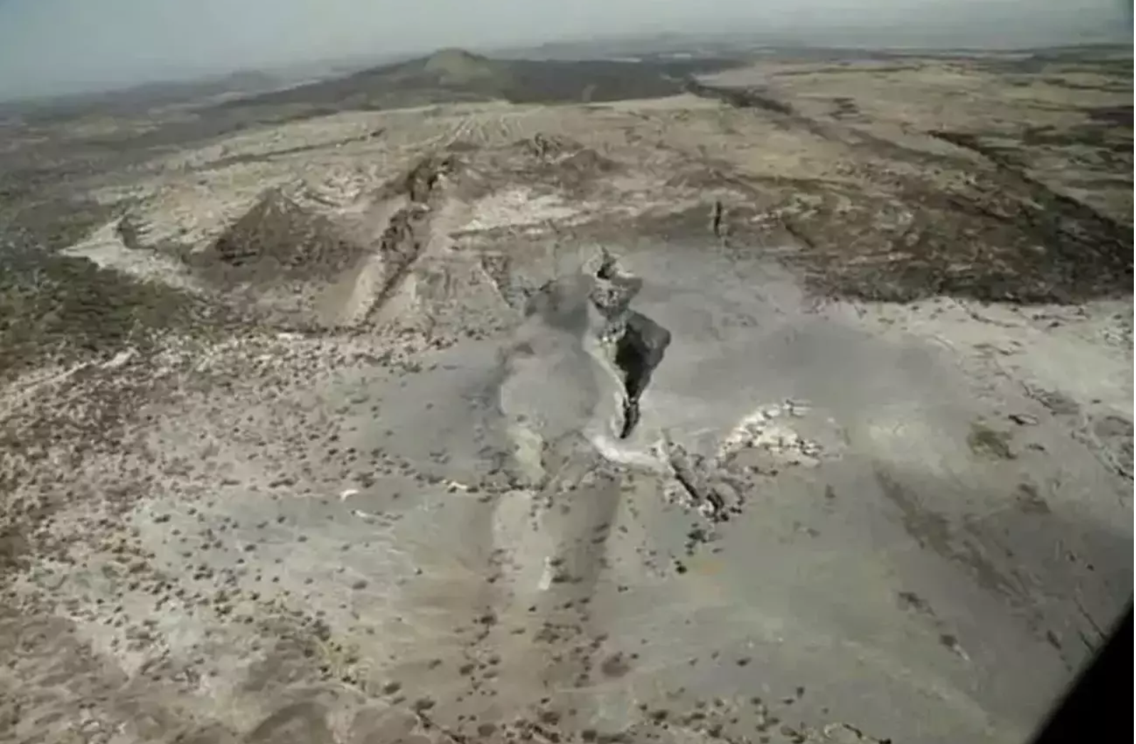
The multinational team revealed that the break, known as the East African Rift, now stretches 35 miles after initially surfacing in the Ethiopian deserts in 2005.
“This is the only place on Earth where you can study how a continental rift becomes an oceanic rift,” said Christopher Moore, a Ph.D. student at the University of Leeds, according to NBC News.
Moore used satellite radar technology to track volcanic activity in East Africa, which is generally connected with the continent’s progressive disintegration.
The crack is located on the boundary of the African, Arabian, and Somali tectonic plates, and the Arabian plate has been steadily migrating away from the African continent for the past 30 million years.
This precise tectonic movement has already been seen, as it is responsible for the formation of both the Red Sea and the Gulf of Aden between the two linked landmasses.
Furthermore, the Somali plate is separating from the African plate, ripping its way across the East African Rift Valley.

Researchers have been able to make detailed measurements of these land changes by using GPS sensors.
“With GPS measurements, you can measure rates of movement down to a few millimeters per year,” Ken Macdonald, a marine geophysicist and emeritus professor at the University of California, noted.
He went on to say, “As we get more and more measurements from GPS, we can get a much greater sense of what’s going on.”
“The Gulf of Aden and the Red Sea will flood in over the Afar region and into the East African Rift Valley and become a new ocean, and that part of East Africa will become its own separate small continent,” Mr. Macdonald said.
The three tectonic plates are moving away from one another at different rates, but according to the geophysicist, the Arabian plate is moving away from Africa at a pace of around one inch each year.
Both the African and Somali plates are believed to be breaking away at a slower rate, ranging from half an inch to 0.2 inch each year.